Impact of European Settlers on Ohio
Lesson Plan

Core Theme:
Growing the Nation – Westward Expansion
Grade Level:
4
Estimated duration of lesson:
50 minutes
Content standards:
Benchmark B: Explain the reasons people from various cultural groups came to North America and the consequences of their interactions with each other.
Grade 4, GLI 2. Describe the impact of the expansion of European settlements on American Indians in Ohio.
Primary Source:
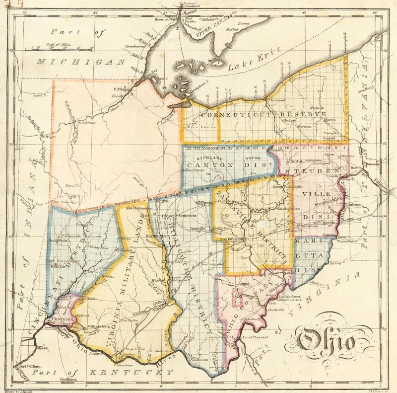
OHS Resource CD, John Melish Map of Ohio, Collection Number: MAP VFM 0003-8, Image #AL02772
A summary of the lesson:
Students will analyze the John Melish Map of Ohio. The will use their background knowledge about the relationships between the Indians in Ohio and the European settlers during this time period to draw conclusions about the cultural and socially impact represented by the map. They will compare and contrast this map to a present day map of Ohio as well.
Instructional Steps:
- Divide students into pairs. Each pair will receive a copy of the John Melish map of Ohio, a present day map of Ohio, and a pencil. Distribute all materials.
- Begin lesson with a class discussion about the uses of maps. Allow several students to share ideas about what types of maps they have seen, what maps are used for, etc.
- Explain to students that they will use both of the maps to answer some questions.
- Distribute spiral question worksheet to each student. Allow time for students to work through questions with their partner.
- Once everyone is finished, go over questions and answers with the entire class.
Post-assessment:
Worksheet results and class discussion and participation will be used to determine whether students understood the activity. Intervention will be offered to those who need it.
Materials needed by teachers:
Materials needed by students:
pencil
